
Here's the thing nobody tells you when you bolt a Starlink dish to the arch: Starlink cannot track your boat. It is a very good internet connection and nothing more. It doesn't know where it is in any way it will share, it won't post your position to a page your mum can watch, and it certainly won't log a track while you're asleep on passage. For that you need something to source a position and push it — and for most cruisers that something is PredictWind.
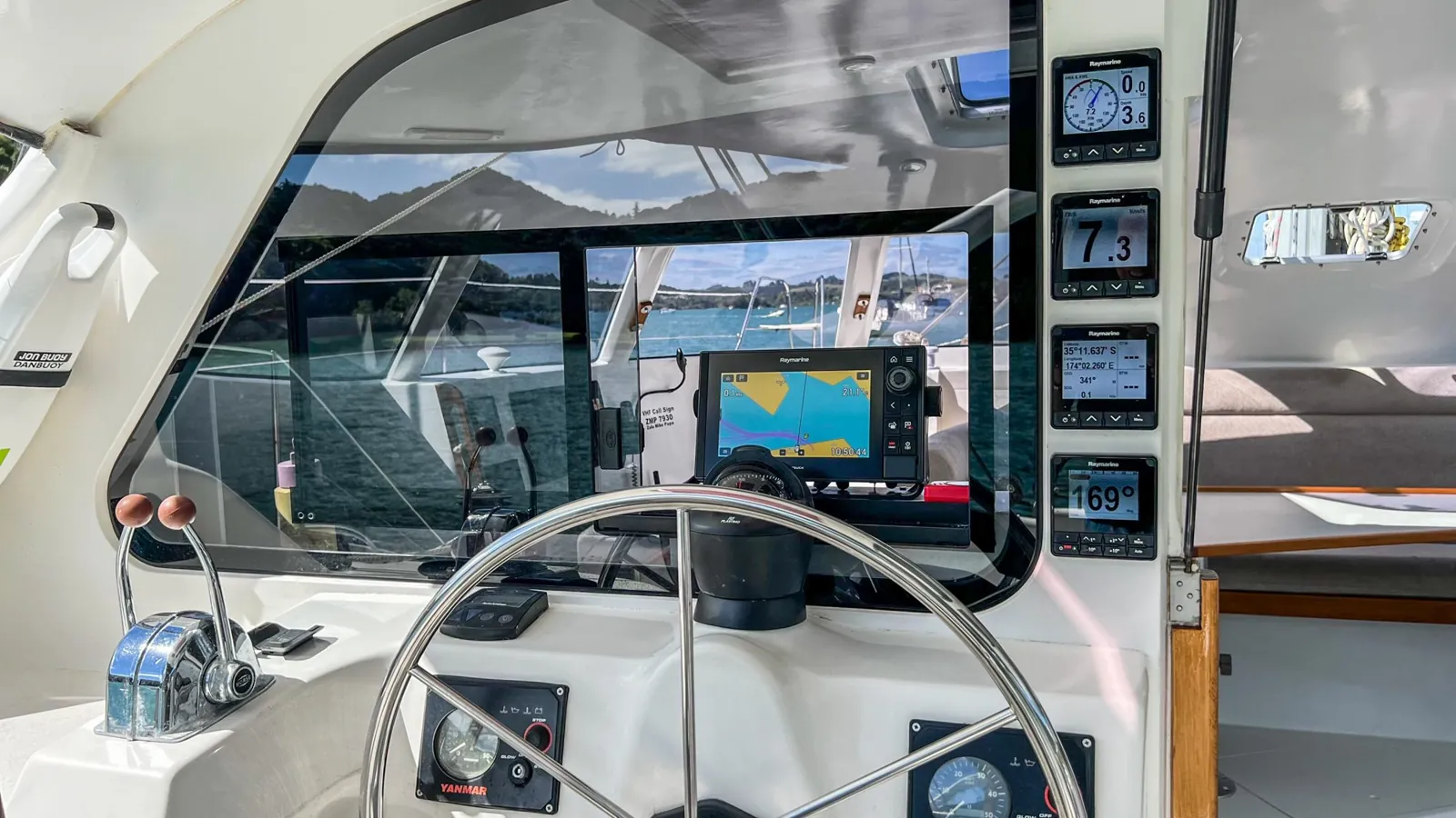
We run exactly this combination aboard Mā Tori: a PredictWind tracker reporting over Starlink, which is what feeds the live map on our tracking page when we're crossing between New Zealand and Fiji. This is the guide we wish we'd had when we set it up.
Menu paths and prices below are current as at August 2026. PredictWind ships firmware updates regularly and moves menu items when it does — if a label doesn't match, check their help centre rather than assuming you've broken something.
First, understand what you're actually connecting
There are three separate things people mash together under "PredictWind tracking", and getting them straight saves a lot of confusion:
Your PredictWind account is the subscription that gets you forecasts, weather routing and the public tracking page. The position source is whatever knows where the boat is — a phone's GPS, or your boat's own NMEA network. The connection is how that position gets to PredictWind's servers, which is where Starlink comes in. Starlink only ever plays the third role. It is the pipe, never the sensor.
So the real question isn't "how do I connect Starlink to PredictWind" — it's "what am I using as a position source, and how does it reach the internet?" Two answers, depending on budget.
The PredictWind Tracker app
Your phone becomes the tracker. It takes its position from the phone's own GPS and sends reports out over whatever internet it has — including your Starlink wifi.
- Nothing to buy or install
- Running on iOS, with Android still listed as coming
- Phone GPS is less accurate than boat instruments
- The phone has to stay aboard, charged and running
The PredictWind DataHub
A dedicated box wired into your NMEA 2000 network and your Starlink. It takes position from the boat's own instruments and does a great deal more besides.
- Instrument-grade position, not phone GPS
- Logs offline and backfills when the link returns
- AIS out to around 300 nautical miles
- Streams instrument data to Navionics, OpenCPN and similar
If you just want people at home watching a line move across an ocean, the app is a perfectly honourable starting point and costs nothing extra. If you want tracking that keeps working when your phone is flat, a position that matches your chartplotter, and the boat's data available around the vessel, the DataHub is the answer.
Connecting Starlink to a DataHub — step by step
Two ways in. If you have the Starlink ethernet adapter, use it: run a cable from the Starlink router to the DataHub's WAN port and it connects on its own, with no menus at all. It's more stable than wifi and it's what we'd fit given the choice. If you're going over wifi instead, here's the full sequence:
- Join the DataHub's own wifiLook for a network named PW-Hub-XXX and connect your laptop or tablet to it. You're configuring the DataHub, so for now you want to be on its network rather than Starlink's.
- Open the admin pageIn Chrome or Safari, go to 10.10.10.1. Log in with username admin and password admin. Change that password later — it's the default on every unit shipped.
- Point it at StarlinkClick WiFi in the top menu, then Enable on the "Connect to Internet (2.4 GHz)" section. Pick your Starlink-XXXX network from the dropdown, enter its password, hit the star button to verify it, then CONNECT.
- Check it's actually onlineGo to Internet Status. The WiFi Internet box should read Status: Online in green. If it doesn't, the password or the channel is usually the culprit — see the troubleshooting below before changing anything else.
- Turn the marine features onThis is the step people miss. Click Internet in the menu — labelled Satellite on firmware 4.11 and earlier — then Starlink. Tick Enable, then enable Tracking, Polars and AIS.
- Save and waitClick SAVE & APPLY and give it up to a minute. It genuinely takes that long, and rebooting the box halfway through is how you end up doing the whole thing twice.
That's it. Position reports start flowing to your PredictWind tracking page, and if you've enabled AIS and polars you'll see those populate too.
When it won't behave. Four fixes cover almost everything. If throughput is poor, open the Starlink app and split the dish's wifi into separate 2.4 GHz and 5 GHz networks rather than one combined band. If it keeps dropping, clear the saved networks at Services > Settings > WiFi > Tools and hit the red CLEAR button, then reconnect fresh. If it's flaky generally, check nothing else aboard is sitting on the same wifi channel — on a boat full of routers, repeaters and chartplotters, channel collisions are the single most common cause. And if none of that works, move the DataHub somewhere with a clearer path to the dish, or give up on wifi and run the ethernet cable.
Why bother with a DataHub when Starlink already works?
Fair question, and the honest answer is that if all you want is Netflix at anchor, you don't need one. What it buys you is everything Starlink deliberately isn't:
It keeps logging when the link drops. Offshore, Starlink drops — obstructions, weather, the boat rolling the dish off its window. The DataHub stores position reports through the gap and uploads them when the connection returns, so your track is continuous rather than full of holes. This alone is why phone-app tracking looks so ragged on a long passage.
It sees other ships a very long way off. AIS reception out to roughly 300 nautical miles gives you early warning of shipping well beyond your own antenna's horizon — genuinely useful on a Pacific crossing where you might see three vessels in a week and want to know about all of them early.
It shares the boat's data around the boat. Instrument data goes out over wifi to whatever you're navigating on — Navionics, OpenCPN — so a tablet in the cockpit sees the same numbers as the plotter.
It watches your data. There's a built-in firewall specifically to stop devices quietly burning expensive satellite airtime in the background. That mattered a lot in the Iridium era; as we'll come to, it matters again now.
It fails over. Starlink is the primary connection, but the DataHub also handles Iridium, 4G/5G and phone hotspots. When one path dies, another carries the tracking.
Plus the softer stuff: AI-generated polars that learn how your boat actually sails and feed weather routing, anchor-drag alerting, and remote access to the boat while you're ashore.
Where this collides with the 2026 Starlink rule changes
This is the part that has changed the calculation this year. Starlink's August 2026 shake-up — Global Roam discontinued and Roam Unlimited capped at 30 days outside your registered country — means a lot of cruising boats will spend part of a season on metered Priority data, throttled after their block, or juggling account localisation with a gap in service.
Every one of those situations is an argument for hardware that logs offline, watches data usage and fails over to another connection. A tracking setup that depends on Starlink being permanently up was a reasonable bet in 2024. In 2026 it isn't, and the boats that sail through the change most comfortably are the ones with a layered setup rather than a single point of failure. We've written up the practical side of that in our Starlink workarounds for Pacific cruisers.
Practical notes before you buy
Power and wiring. The DataHub runs on anything from 9 to 60 V DC with reverse-polarity protection, so it's happy on a 12 V or 24 V boat. It ships with a 12 V supply, an active GPS antenna, a GPS patch antenna, adapter plugs and a fused power cable — so there's little to source separately beyond the NMEA 2000 drop and, if you want it, the Starlink ethernet adapter.
Subscriptions. The hardware itself carries no ongoing fee. Be aware, though, that some of the headline features — the AI polars, AIS broadcast over wifi and the Anchor Alert app — sit behind a Professional-tier PredictWind account. The box isn't subscription-locked; parts of the ecosystem around it are. Worth pricing the whole picture rather than just the unit.
Which model. There's now a DataHub Pro at US$599, adding Wi-Fi 6 with much higher throughput, a T-Mobile LTE SIM, and readiness for Starlink's direct-to-cell service — initially aimed at 12 nautical miles offshore in the US, with other regions to follow. If you cruise the South Pacific, direct-to-cell is not a reason to buy today; if you're coastal in the States, it might be. The standard DataHub remains the sensible choice for most offshore boats.
The short version
Starlink is the pipe, not the tracker. To get a position onto a PredictWind tracking page you need either the Tracker app using your phone's GPS over the Starlink connection — free, easy, less accurate — or a DataHub wired to your NMEA network, which gives instrument-grade position plus offline logging, long-range AIS, data streaming and failover. Connecting the two is a ten-minute job: ethernet into the WAN port if you can, otherwise wifi via 10.10.10.1, and the step everyone forgets is enabling Tracking, Polars and AIS under the Starlink menu afterwards. With Starlink's roaming rules tightening, the offline-logging and failover side of that hardware has quietly gone from nice-to-have to the reason you buy it.
Keep reading: the rule changes driving all this are in Starlink's new rules for cruisers and the workarounds for Pacific cruisers. For the sailing side of offshore life, try our interactive catamaran reefing guide, or see the boat all of this is fitted to in our Fusion 40 review — she's our Fusion 40 catamaran for sale now.